
|
|
|
|||||||||
| Cartography | ||||||||||
|
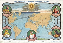
'So in the development of
cartography or mapology, it was the custom from the earliest times to
draw maps which were ornamental as well as useful. In the absence of
lighthouses and buoys, the appearance of the shore, its contours and
the houses upon it were significant. In the manuscript and printed maps
of the fifteenth and sixteenth centuries the cardinal, and later the
ether points of the compass, were frequently represented by heads, often
of cupids with full cheeks, blowing from near the margin of the charts,
and indicating the direction of the winds from these quarters. The points
of the compass first appeared as a four-leaved rose, which became later
eight, sixteen and thirty-two leaved, as knowledge of the compass increased.
A country was represented not merely as land of such and such a size
and shape, but forests and mountains were actually depicted and the
size and importance of the cities were indicated by symbolic houses,
small and few for villages, large and many for cities.' — Louis A. Holman, Old Maps and their Makers 'I wisely started with a map, and made the story fit.' — J.R.R. Tolkien 'I tried to visit Albania but I couldn't find it on the map.' — Oscar Wilde |
||||||||||
| |
||||||||||


 |
||||||||||
|
|
||||||||||
| |
||||||||||
 |
||||||||||


