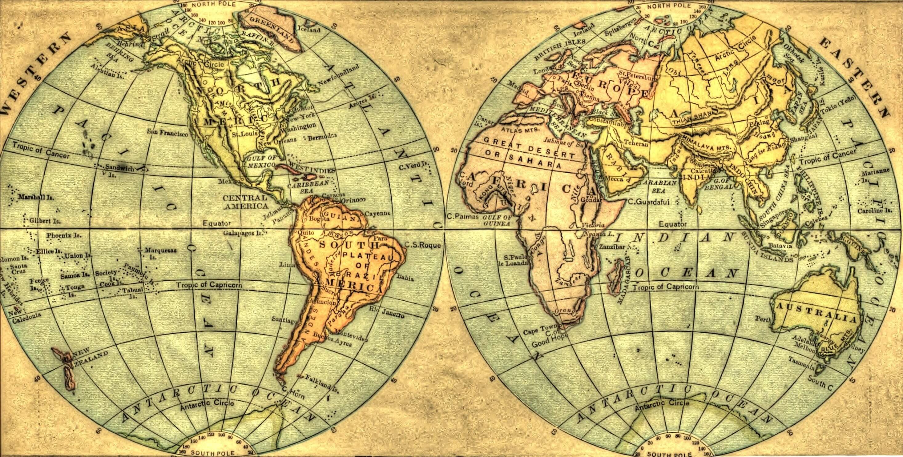
Western
(New World) and Eastern
Hemispheres, 1883
A map is a picture of the whole or of a portion of the earth's
surface. The top of the picture is the north, the bottom the south;
the right hand the east, and the left hand the west. The map is
crossed from north to south and from east to west by curved lines.
On a circular map of a hemisphere, the north and south lines will be
seen to terminate in the poles, and to be halved by the equator.
These are termed meridians, and measurement on them north or south
of the equator is latitude. The east and west circles run in the
same direction as the equator (only bending to imitate on a plane
the roundness of the earth), and are hence termed parallels. They
necessarily become smaller towards the poles. Measurement on the
equator, or on any parallel, is termed longitude. The meridians
divide the parallels into longitude; and the parallels divide the
meridians into latitude. Latitude ends in the pole;
longitude extends round the circle. These measurements are used to
find the situations of places. Every place must be both on a
parallel and on a meridian—that is, it must be at the spot where
they cross. For these measurements every circle great and less is
divided into 360 parts, called degrees—marked thus, 360°. Each of
these parts is sub divided into 60 minutes—marked thus, 60’. On a
great circle, or one dividing the globe equally, a degree is 69·05,
or 69 1/20 English miles in length. Any meridian may be selected as
a first meridian. The maps of this country [England] always reckon
as the first the meridian of Greenwich Observatory, near London.
Places on that meridian, from pole
to pole, have no longitude; places east or west of it have so many
degrees of east or west longitude. Latitude always begins from the
equator, which is marked 0: places north of it have so many degrees
of north latitude measured on their meridian. The sides of a map are
portions of meridians; the top and the bottom are portions of
parallels. To find the latitude and longitude of a place, therefore,
trace with the finger to either side eastwards or westwards; and to
the top or bottom, northwards or southwards; the degrees of latitude
and longitude will be met by the finger on the map’s edges. The
distance of two places on a map may be found generally, but not very
correctly, by stretching a thread or the legs of a pair of compasses
between them; and finding on the map’s side how many degrees that
space includes, the multiplication of the degrees by 69 1/20 or by
70 will give approximately the
distance in English miles.
—
The Symbol Atlas, and Geographical Text-book, 1843